|
Tahoe Nugget #32:
Growing the Sierra Snowpack
Building the Sierra snowpack can sometimes be a painful process. Wet and warm Pacific storms have been slamming the West Coast since before Christmas, but the big powder dumps that skiers, boarders and
photographers love have not been part of the holiday fare. Because these storms lack cold air support, freezing levels have been stubbornly high, and only the upper elevations (above 7,500 to 8,000 ft.) have been
accumulating significant snowfall. Nonetheless, Squaw Valley's upper slopes have picked up more than 10 feet of snow this season, while the Kirkwood ski area just south of Lake Tahoe is boasting nearly 16. 5
feet so far.
The NWS has posted a Winter Storm Warning and a Flood Watch for up to 10 inches of water (rain plus the water equivalent in snow) falling over the next 36 hours. Wind gusts approaching 100 mph
and blinding blizzard conditions have shut down chair lifts on the upper portions of all the big ski areas. The stormy weather has definitely been a downer for resort operators trying to cash in on the busy holiday
ski week, but the wet snow that is accumulating up top is setting us up for a nice solid base to ski on over the next 4 to 5 months.
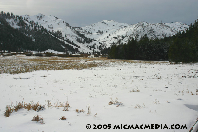
This photo of the Squaw Valley ski area was taken on Dec. 29, 2005, at 2
p.m., just minutes before a large avalanche broke free under the Headwall chairlift, about halfway down from the center peak. The slide path, which was 250 feet long by 200 feet wide, was caused by an abrupt
temperature change. Between 11 a.m. and 2 p.m. that day, the temperature plummeted nearly 20 degrees. Note the lack of snow on the valley floor at 6,200 feet elevation.

|


