 |
|
|
Follow Mark on Facebook for more stories |
||
 |
|||||
|
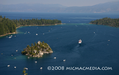
Tahoe Nugget #149 Rubicon Trail: Top 10 Tahoe Hike Lake Tahoe's Rubicon Trail starts at the south end of D.L. Bliss State Park near Calawee Cove. The path leads to the mouth of Emerald Bay and then on to the Vikingsholm Castle, one of the best examples of Scandinavian architecture in the United States. It is a 7 mile round trip to Emerald Bay and back, on an impressive, well-designed trail. Much of the hike affords spectacular views of "Big Blue" except when crossing a moderate ridge that separates Rubicon Point from the beaches and coves leading to Emerald Bay. Although the trail negotiates rugged terrain, it is a relatively easy walk with little elevation gain. Keep your eyes peeled for osprey and bald eagles diving for fish. You can see their large nests perched on several dead tree stags towering above the forest canopy. Just off the rugged shoreline, the water is more than 1,000 feet deep. Along the way, one can take a short diversionary walk up to an abandoned lighthouse that was once the world's highest lighthouse on a navigatable body of water. In 1916, the U.S. Congress appropriated funds to construct four navigational lamps at Lake Tahoe to help steamer pilots cruising the large lake. The Rubicon Point Lighthouse was built in 1919 at a cost of $900. A flashing 70 candle powered light was visible for 7 miles. In 1921, the lamp was moved north to Sugar Pine Point and the Rubicon site was abandoned. Vandalism, graffiti and exposure nearly destroyed the lighthouse, but in 2001 the structure was stabilized to help preserve it for future generations. Photo #1: Rubicon trailhead above Calawee Cove.
|
|||||
|

