 |
|
|
Follow Mark on Facebook for more stories |
||
 |
|||||
|
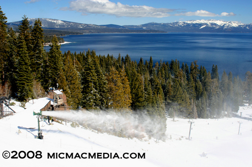
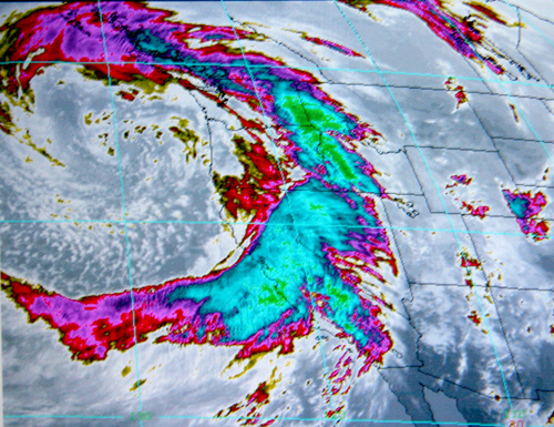
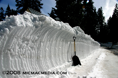
Tahoe Nugget #140: 2008 Winter Breakdown Don't look now, but another Tahoe winter has bit the dust. And a strange winter it was. The 2008 water year does not officially end until September 30 (the historic low-point for water flow and reservoir storage in the Sierra Nevada), but for all intents and purposes the rainy season is over. It was an interesting season in that two separate storm periods over the course of five weeks produced the bulk of the winter's precipitation. The heavy and persistent snowfall during January and early February made national news. Besides ensuring great skiing and snowboarding conditions, the big snowstorms also allayed fears of another dry winter like we experienced in 2007, which turned out to be one of the driest on record at the Central Sierra Snow Lab at Soda Springs near Donner Pass. People were therefore very concerned when this past winter was slow out of the gate, with much-below average snowfall during November (Squaw Valley picked up only 8 inches all month). It was California's 16th driest November in 113 years. December was no barnburner when it came to snowfall, but several decent storms before the all-important Christmas holidays saved the day economically. The storm door blew open dramatically in early January, when a powerful low- pressure system from the Gulf of Alaska walloped California with high winds and heavy rain and snow. Low snow levels minimized flooding, but destructive wind gusts uprooted trees and knocked out electric power to millions of people. Another round of storms pounded the Pacific Coast in late January into early February, a few which reached bone-dry Southern California. The 2007 water year had been the driest on record for the southland, but in the last part of January 2008, Los Angeles, picked up more rain in that week than the city had received for all of 2007. By early February, state hydrologists felt optimistic about the healthy Sierra snowpack and forecasted normal flows for the spring runoff. Unfortunately, the storm track shifted after the first week of February and the intense, snow producing weather pattern was gone for good. Tahoe ski resorts enjoyed one more significant winter storm, a healthy 5- foot barrage of snow during the third week of February, but for the rest of the season Squaw Valley received only a meager 35 inches of additional snow on the upper mountain at 8,200 feet in elevation. The dry March was followed by an even more parched April, so it now appears that this spring (March, April, May) will go down as the driest on record for the Northern Sierra. We're talking about a real winter breakdown here. The lack of late winter precipitation diminished the snowpack and reduced runoff forecasts. On April 1 the statewide snowpack looked good with just under 100 percent of normal, but by May 1 water content had plummeted to just 61 percent of average west of Donner Pass. Considering that some of the major ski resorts pulled in about 36 feet of snow this winter, it may seem counter-intuitive that the Central Sierra Snow Lab received LESS precipitation this year than during the seemingly snowless winter of 2007. During water year 2007, a total of 45 inches of precipitation was recorded at Soda Springs. This year, despite the impact of many impressive snowstorms, only 43 inches of water have been measured at the Snow Lab so far. That's because the most significant storm events were cold (Gulf of Alaska origin) and the snow often dry and powdery. Dry snow has greater loft and will measure deeper than wet snow, but it won't contain more water. Precipitation is snow melted for its liquid content combined with rainfall measured in the gage.) The winter of 2008 really went bust in March and April, but in January and February skiers at Tahoe resorts were chest-deep in Rocky Mountain powder due to the low temperatures associated with a strong Gulf of Alaska storm track. The Pacific moisture tap ended very early this year, but ski and boarders can still appreciate the quality, and quantity, of snow that did fall in 2008. Photo #1: Due to a lack of natural snowfall early this season, Tahoe ski resorts cranked up their snowmaking equipment.
|
|||||
|


