|
Tahoe Nugget #117:
Tahoe's Angora Firestorm
July 15, 2007
On June 24, 2007, an illegal, unextinguished campfire exploded into Lake Tahoe's worst wildfire since the region's settlement by white pioneers in the 19th century. Located near Angora Peak and Angora Lakes
just west of South Lake Tahoe, the Angora Fire burned 3,100 acres and forced thousands to flee their homes. At one point there were more than 2,000 firefighters battling the blaze in heavy timber backed by trucks,
bulldozers, tanker planes and helicopters. Despite the massive fire fighting effort which lasted seven days and cost more than $10 million, 254 homes and about 75 commercial buildings were destroyed. Due to bone-dry
forest conditions and gusty, erratic winds, the firestorm spread rapidly into nearby neighborhoods, but amazingly there were no fatalities among residents and injuries among firefighters were limited to minor
scrapes and a broken hand (when a large boulder rolled free and hit one firefighter).
Authorities have been warning of a catastrophic wildland fire in the Tahoe Basin for years now, due to dense underbrush
and stands of diseased and dying trees. The unhealthy forest conditions are a result of logging during the Gold Rush and Comstock-era mining boom. Timber barons made millions of dollars by clear-cutting about
two-thirds of the basin's watershed. The original mixed-growth forest of fire-retardant species like the Jeffrey pine was replaced by uniform stands of dense white fir and undergrowth, which grew rapidly in the
unusually wet years of the early 20th century. Fir trees are especially vulnerable to drought and beetle bark infestations. A century of fire suppression and a mixed bag of forest management policy has set the stage
for a major burndown.
Residents who own homes in the forest-suburb interface are encouraged to protect their property with defensible space procedures like removing dead trees and clearing roofs of
accumulated pine needles. During the firestorm there was widespread speculation that trees carried a crown fire (from tree-top to tree-top) and that ignited the homes. But after an on-the-ground review by the U.S.
Forest Service, it turns out that most of the burned homes in the Angora Fire burned when wind-driven embers ignited combustible material on or adjacent to the houses. The Forest Service cited examples such as
wooden shingle roofs, wooden decks, pine needles on roofs or in gutters, wood stacked next to homes and fire brands reaching into attics through vents. Property owners tried to place the blame on several different
agencies, but ultimately homeowners should take personal responsibility for the safety of their homes.
Since the Angora firestorm forest management policies have been under intense review and some positive
changes will hopefully be implemented. One obvious difference between state policies by Nevada and California (who share the Tahoe Basin), is that Nevada has dedicated $3.5 million over the past three years to help
woodland property owners pay for preventative measures. California, with greater forest coverage, offers no state money for similar work. Nevada generally subsidizes two-thirds of the cost of defensible space
projects on private property with homeowners generally paying the rest in cash or sweat equity. While California provides no direct funding from its own budget to help owners with clearing projects, it does fund
large-scale work aimed at protecting whole communities. But as the Angora Fire shows, thinning and clearing around individual structures works and is considered vital to a robust defense against forest fire damage.
Regardless of state policy, I believe that homeowners should take the initiative and responsibility to safeguard their own property.
Yesterday, July 14, I visited part of the Angora fire zone to
photo-document the burnt forest and see what changes had occurred. The following pictures give a glimpse of the scene. In places the ash on the ground was up to five inches deep, a concern for environmentalists who
worry that runoff of the ash this winter may diminish (temporarily?) the clarity of Lake Tahoe's waters. I took many photos of the fire zone, but will only include six here. I may consider a follow up Nugget in
the near future.
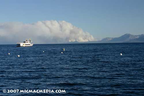
Photo #1: Angora Fire smoke plume on Sunday, June 24, the day the fire started. View from Carnelian Bay on Tahoe's north shore.
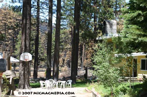
Photo #2: Note how close fire got to
homes, but were saved by fire fighters who held their last line of defense.
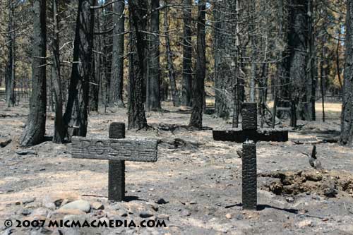
Photo #3: Among the casualties were these markers for pets buried in a makeshift forest cemetery.
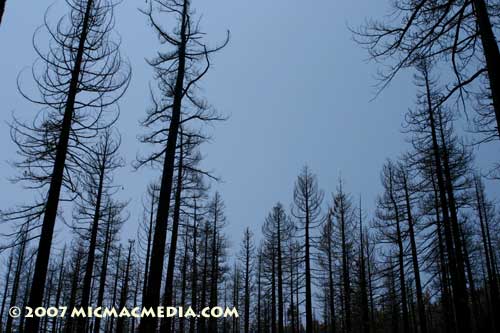
Photo #4:
With the forest canopy gone, the area felt about 10 degrees warmer than the unburned wooded areas. It felt eerily like the forest floor was still smoldering with heat.
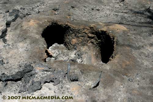
Photo #5: Note how the roots of the
trees burned underground due to the extreme heat.
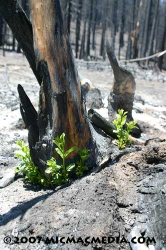
Photo #6: Less than two weeks after the fire was put out, new green growth signals the beginning of forest regrowth.
|


