|
|||||||||||||||||||||||||||||||||||||
|
Follow Mark on Facebook for more stories |
|||||||||||||||||||||||||||||||||||||

 |
||||
|
Short but Sweet: Weather Analysis of 1999-2000 Summer is here and another ski season is in the bag. Sierra weather stations follow a water year schedule that runs from October 1 to September 30, but for all intents
and purposes, the winter of 1999-2000 is history. Last year's storm pat The northern Sierra dodged a climatological bullet last year. A persistent La Niña event in the Pacific Ocean portended possibly dry conditions for the region, but the episodic cooling of sea surface temperatures (SST) that began in June 1998 opened the storm door long enough to avoid a drought year. (Some of the driest years in Sierra Nevada history have occurred during La Niña events.) Last year was a wild roller coaster ride of weather extremes, with virtually no precipitation in Truckee during December and March (17% & 20% respectively), offset by near-record storms in January and February (156% & 179% respectively). After four months of record warmth and little precipitation (Sept.-Dec.), hydrologists were not surprised when the January 1, 2000, snow survey at Echo Summit (South Lake Tahoe) revealed a snowpack at 24% of average. (Western Nevada had just logged the warmest autumn in the 112 yearlong record.) But weatherwise loca
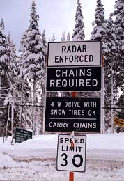
Tahoe-Truckee locals kept the faith and continued to pray for snow. Fortunately they didn't have long to wait. In the middle of January, high pressure in the eastern Pacific succumbed to an active jet stream that had finally pulled south. A storm on January 11 blasted the region with heavy rain and snow. More vigorous cold fronts invaded ten days later , and they kept coming. Sacramento suffered a deluge of 4.26 inches of rain in two days, making it the sixth wettest 48-hour rainfall on record. That moisture translated into bomber storms in the Sierra where the National Weather Service had posted Winter Storm Warnings. The multi-day blizzard dumped more than seven feet of snow in the mountains. Several locations netted snowfall at the rate of more than one inch per hour for 60 hours. The tremendous snowfall was manna for ski resorts, but the avalanche danger reached critical levels. One avalanche that tore down a north-facing slope in Heavenly's Mott Canyon ranked as a Class V, the highest a slide can receive. Another wall of snow 50-yards wide slid across both lanes of Mount Rose Highway, and an avalanche trapped a Woodfords, California man for 45 minutes on Carson Pass. Throughout the Sierra avalanches swallowed nine people. Amazingly, all of them survived, including one man who was rescued by a search and rescue dog after six hours trapped under snow in Lassen Volcanic National Park. (Less than 25% of avalanche victims buried for one hour survive. The survival rate drops rapidly after that.) Storms pounded the West relentlessly throughout February, assaulting California and the Sierra with heavy rain and snow. San Francisco rainfall totaled a February-record 14.89 inches, 304% of normal. Sacramento endured its fifth wettest February on record. Extensive flooding in the lowlands was matched by heavy snow in the higher elevations with rain below 5,000 feet. Poor visibility, frequent accidents and road closures made for nasty driving over the passes. On Valentine's Day wind gusts along the ridges reached 172 mph at Alpine Meadows; the top wind gust ever recorded there is 186 mph. The exceptional winds toppled trees throughout the region and knocked out power to 16,000 people. A lull between systems during the all-important President's Day holiday allowed winter sports enthusiasts a rare chance to enjoy the excellent snow conditions in the mountains. Virtually every ski area reported all-time record crowds. By the end of February, ski area snowpacks ranged from 14 feet at Boreal, 16 feet at Alpine Meadows , and an incredible 24 feet at Kirkwood. Early March storms added a few more feet to the snowpack before the storm door slammed shut for good. A sharp cold snap in mid-May brought a surprise snowfall to the Sierra, but caused serious tree and plant damage in much of Nevada. Typical of western weather that the unwelcome outbreak of frigid air came on the heels of the warmest winter in Nevada's history. (In fact, last winter was the warmest ever recorded for the United States.) Although fair and warmer weather and north and northeasterly winds caused sublimation losses of water from the snow and early melting of the pack at lower elevations, water storage in the Sierra is still above average. (Sublimation occurs when ice evaporates directly into the air, skipping the liquid stage.) NOAA's Climate Prediction Center projects the current La Niña event will weaken but linger through year 2000, with near-normal SSTs by early 2001. This large-scale oceanic and atmospheric circulation pattern should continue the severe drought in the southeastern United States and trigger an above average Atlantic hurricane season. For those Sierra residents and visitors already contemplating next year's powder turns, the long range forecast for winter 2000-2001 is for above average precipitation in Northern California. According to tree ring studies dating back to 1601, a seventh consecutive wet winter would be unprecedented, but heck, we'll take it. Mark McLaughlin's books, Sierra Stories: True Tales of Tahoe are available at local bookstores. |
||||
 tern arrived late and departed early, but a juicy flow in late January, February, and early March dumped enough moisture in seven weeks to tie a
record. Winter 1999-2000 goes into the climate record book as the sixth wet year in row, a feat achieved only twice before in Northern California in the last 400 years. Although some may quibble
that precipitation values in the North Lahontan hydrologic basin are shy of average (97% in Tahoe City and 89% at the Truckee Ranger Station), most communities on the Sierra west slope
received above average precipitation last year. The weather station at Blue Canyon has picked up 66.66 inches of precipitation so far, about 110% of normal. (Precipitation is rain and melted snow combined.)
tern arrived late and departed early, but a juicy flow in late January, February, and early March dumped enough moisture in seven weeks to tie a
record. Winter 1999-2000 goes into the climate record book as the sixth wet year in row, a feat achieved only twice before in Northern California in the last 400 years. Although some may quibble
that precipitation values in the North Lahontan hydrologic basin are shy of average (97% in Tahoe City and 89% at the Truckee Ranger Station), most communities on the Sierra west slope
received above average precipitation last year. The weather station at Blue Canyon has picked up 66.66 inches of precipitation so far, about 110% of normal. (Precipitation is rain and melted snow combined.)
|